
2007 Vacation: Day 2 Summary
Day 2 Summary
Bismarck, North Dakota to Dickinson, North Dakota
Although there were a few differences, the second day of my 2007 vacation resembled the second day of my 2006 vacation. As a consequence, I’ll direct you to the day 2 report of my 2006 vacation and only point out the differences between 2006 and 2007 in this report.
One of the biggest differences was the route taken to get to Dickinson from Bismarck. In 2006, the route was pretty straightforward: I traveled along what’s left of the precursor to Interstate 94, the now-decommissioned U.S. Highway 10. This year, however, I yearned a bit beforehand to deviate from this path and visit the Beulah and Hazen areas. These two cities lie within the heart of the vast lignite coal fields of North Dakota and, as a result, contain numerous coal-fired power plants and related industries that, quite often, employ fresh blood from UND’s School of Engineering and Mines.
To get to this area from Bismarck, I decided to first take ND Highway 25 from just west of Mandan to Center, an aptly named city of 678 located in both the center of its county and state.
Although there’s a lot of North Dakota that is extremely rural, the area to the north and west of Mandan seems to be even more so. The hilly, treeless land around Center is better suited for coal mining than farming, meaning that not much settlement has ever occurred. In fact, Center is actually the last remaining city in its county (Oliver), which has a total population of only 2,065.
From Center, I got on ND Highway 48. A little more than 9 miles north of town, the highway ends at an intersection with ND Highway 200A and crosses the border of Mercer County, which also happens to be the border between the Central and Mountain Time Zones.
As the cities of Hazen and Beulah were located still farther to the west, I got on ND Highway 200A heading west. The barren, hilly landscape that I had traveled through since Mandan briefly gave way to a lush, cottonwood-laden landscape as the road traveled close to the Missouri River.
The change in landscape was short-lived, however, as the roadway exited the Missouri River Valley a little west of Stanton. Once more, the chief scenery consisted of barren hills and the stacks from close by coal-fired power plants.
West of Stanton, the next city on highway 200A is Hazen. This community of 2,457 is one of the largest in central North Dakota and, along with Beulah – a mere 10 miles away – makes up a 5,609 person “metropolitan area” that is the center of commerce and industry in the region.
Although I didn’t see any notable tourist attractions in Hazen while I was planning this vacation, I saw some signs pointing to the Riverside City Park while in town. I didn’t know what sort of park this might be, but I figured it might be a good idea to check it out.
The park ended up being in a secluded area nearly a mile south of town. Nevertheless, it turned up being an excellent tourist attraction for me, since it included an interesting and informative tree walk. Somewhere along the line – I believe I read that it was in 2000 – the Arbor Day Foundation donated a few dozen trees for public display. What’s more, every tree contains a placard describing what type of tree it is. I think I spent a good half hour, or maybe more, walking around the park, looking around at all the unique trees. It was a very enjoyable experience that I think would have been even more so had the trees appeared to be in better condition. Sadly, many of them appeared to be in rough health; the biggest problems were leafless branches and leaves being eaten by hungry insects. Hopefully the city of Hazen doesn’t let the collection worsen any further, as it really is a distinctive tourist attraction.
Before going to Beulah, I took a little detour and went to the Freedom Mine and Great Plains Synfuels Plant. The former is one of the largest coal mines in the area, while the latter is a large coal gasification plant – coal from the nearby mine is brought there and chemically converted to natural gas.
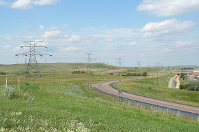
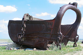
Since I didn’t know what, if anything, I’d be able to see of either the mine or the plant beforehand, it was nice to find a scenic overlook on a hill right across from the gasification plant. The overlook provided not just a good view of that place, but also of the coal mine as well as surrounding countryside. In addition, it had a huge scoop, presumably from one of the machines that once worked hard to scrape coal out of the strip mine.
After seeing the mine and plant, Beulah was next stop. The city is set in the deep Knife River Valley, so if you come in from the north (like I did), you start off relatively high in elevation and keep descending and descending until you finally reach the downtown part of the city.
From Beulah, it was off to ND Highway 49 to Glen Ullin, 30 miles south. While scenic, the landscape on this road was void of pretty much any signs of inhabitation. There was another coal mine or two, but that was about all.
Once in Glen Ullin, I got on the old U.S. Highway 10 to head toward Dickinson. The weather forecast had earlier mentioned the possibility of severe weather later in the afternoon, and by the time I got to Hebron, this forecast was appearing more and more accurate. Though the sky had gotten dark and more ominous while I was still in Beulah, it was very dark in Hebron. I waited around town until the inevitable storm blew past, which ended up happening with relative ease. The only thing Hebron got was a few sprinkles of rain and a few flashes of lightning; the worse part of the storm passed to the south, where it spawned a brief tornado warning.
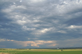
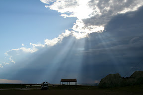
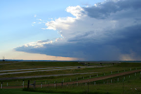
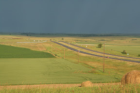
As that storm continued moving eastward, the sky to the west started clearing. Eventually, the sky cleared enough to let the sun come out and dramatically light up the storm clouds pushing to the east.
As luck would have it, the sun came out right about at the time when I reached the hill north of Gladstone with the “Geese in Flight” metal sculpture advertising the nearby “Enchanted Highway.” The scenes from the hill were absolutely beautiful lit up the way that they were (check out the pictures below).
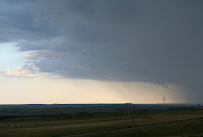
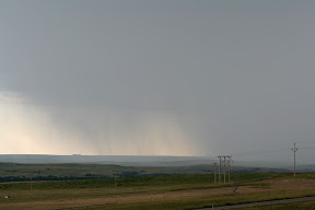
The sun was only present for a short while, though, as another storm fired up to the west and once again made the sky cloudy. Incredibly, this storm started moving right toward Gladstone and the hill I was on. I got to see nearly everything: the storm develop from out of thin air, grow in intensity, and finally pass directly overhead, bringing a torrential downpour, a little bit of lightening, and gusty winds.
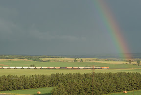
The storm was well below severe thresholds, however, and only lasted a couple of minutes. Nevertheless, it provided a pretty neat experience. The sun even came out, once more, after the storm passed and brought with it a short-lived rainbow.
After enjoying the scenery from the hill for just a while longer, it was time to go the 11 miles to Dickinson to end the second day of my vacation.
Pictures:
The first nine photos were taken in Menoken, the small town east of Bismarck that the railroad has almost always called Burleigh
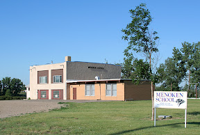
Menoken has a small school, still in use for grades K-8. Enrollment has dropped in recent years, however, as parents now have the option to send their children to the schools in Bismarck for more than just high school.
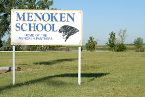
The Menoken School sign
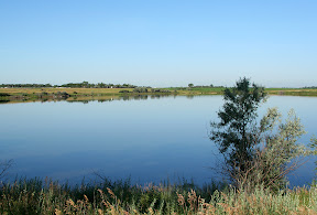
Behind the school is a small pond
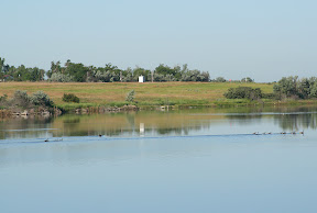
There were a lot of geese swimming in the pond
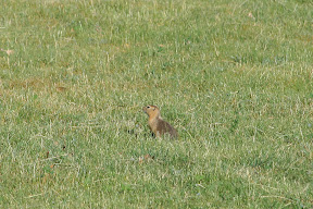
One of the many gophers(?) that were roaming around the school grounds
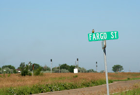
Fargo St. in Menoken
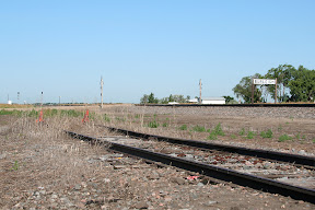
The tracks in Menoken, with the Burleigh station sign prominent in the background
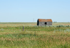
An abandoned farm building to the east of Menoken
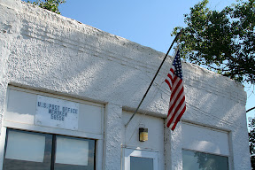
The Menoken Post Office was one of the only places still open for business in the city's "downtown"
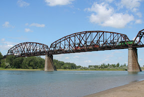
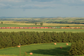
An eastboudn train goes across the Missouri River in Bismarck
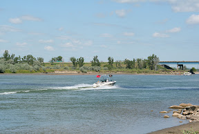
Boating on the Missouri

This recently-placed sculpture was on display in the park next to the Missouri River in Bismarck
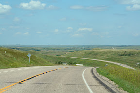
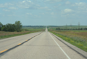
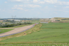
Some scenery on the road to Center
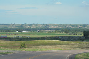
Some more scenery near Center
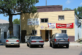
Der Imbiss Bar & Grill in Center
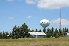
The Center water tower is on top of a small hill on the city's east side
At The Missouri River Valley near Stanton
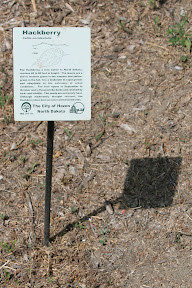
An example of one of the placards next to each of the trees in Hazen's Riverside Park
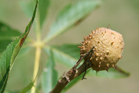
A buckeye growing on an Ohio Buckeye tree in Hazen's Riverside Park
The following five pictures are from the scenic overlook near Beulah

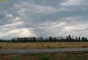
After the first storm passed when I was near Hebron, the second storm started firing up to the west
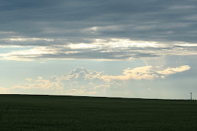
The remnants of the first storm I saw
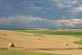
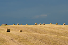
The following ten pictures were taken from the hill with the "Geese in Flight" sculpture. You can see the storm clouds from the first storm illuminated by the sun, the second storm coming in and blocking the sun, the second storm building in intensity and pushing westward, and, finally, the sun coming out once again after the second storm's passage.
Videos:
An overview of the scenic overlook near Beulah
http://www.youtube.com/watch?v=rfahZ8vcRvY
An overview of the hill near the "Geese in Flight" Enchanted Highway Sculpture
http://www.youtube.com/watch?v=FDvxrEzYTF4
An somewhat of a timelapse video of the thunderstorm passing overhead at the "Geese in Flight" sculpture
http://www.youtube.com/watch?v=Jfv9Tx3hbNc
The first nine photos were taken in Menoken, the small town east of Bismarck that the railroad has almost always called Burleigh
Menoken has a small school, still in use for grades K-8. Enrollment has dropped in recent years, however, as parents now have the option to send their children to the schools in Bismarck for more than just high school.
The Menoken School sign
Behind the school is a small pond
There were a lot of geese swimming in the pond
One of the many gophers(?) that were roaming around the school grounds
Fargo St. in Menoken
The tracks in Menoken, with the Burleigh station sign prominent in the background
An abandoned farm building to the east of Menoken
The Menoken Post Office was one of the only places still open for business in the city's "downtown"
An eastboudn train goes across the Missouri River in Bismarck
Boating on the Missouri
This recently-placed sculpture was on display in the park next to the Missouri River in Bismarck
Some scenery on the road to Center
Some more scenery near Center
Der Imbiss Bar & Grill in Center
The Center water tower is on top of a small hill on the city's east side
At The Missouri River Valley near Stanton
An example of one of the placards next to each of the trees in Hazen's Riverside Park
A buckeye growing on an Ohio Buckeye tree in Hazen's Riverside Park
The following five pictures are from the scenic overlook near Beulah
After the first storm passed when I was near Hebron, the second storm started firing up to the west
The remnants of the first storm I saw
The following ten pictures were taken from the hill with the "Geese in Flight" sculpture. You can see the storm clouds from the first storm illuminated by the sun, the second storm coming in and blocking the sun, the second storm building in intensity and pushing westward, and, finally, the sun coming out once again after the second storm's passage.
Videos:
An overview of the scenic overlook near Beulah
http://www.youtube.com/watch?v=rfahZ8vcRvY
An overview of the hill near the "Geese in Flight" Enchanted Highway Sculpture
http://www.youtube.com/watch?v=FDvxrEzYTF4
An somewhat of a timelapse video of the thunderstorm passing overhead at the "Geese in Flight" sculpture
http://www.youtube.com/watch?v=Jfv9Tx3hbNc
Labels: 2007 Vacation, Pictures
posted by Mitch Wahlsten at 12:44 AM
1 comments
![]()


1 Comments:
You live in North Dakota. Why would you want to take another trip through the State? I hope it gets better. sw
Post a Comment
<< Home