Mitch's Blog 7.0

Mitch's Blog


Monday, August 06, 2007

2007 Vacation: Day 10 Summary

Day 10 Summary
Hallock, Minnesota to Brainerd, Minnesota


The final day of my 2007 vacation began in Hallock, in Minnesota's far northwestern corner. Although the city only has 1,196 residents, it nevertheless is one of the most important cities in its locale in Minnesota. One of the reasons for this is undoubtedly because it is the county seat of Kittson County.

I don’t know what it is, but I really like the northwestern corner of Minnesota. It’s a unique part of the state due to its connectedness with Canada. Ecologically speaking, the region is also quite unique, since it lies within Minnesota’s only example of a tallgrass aspen parklands system. As such, the scenery can be described as being a transition zone between tallgrass prairie and aspen forest. There really is no other place in Minnesota that looks exactly the same.

Kittson County is one of the only counties in Minnesota that has no natural lakes. The sole lake in the county, Lake Bronson, was created in the 1930s when a dam was built along South Branch of the Two Rivers.

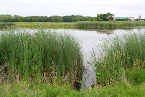
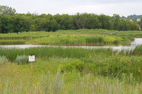
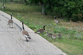
As it turned out, Lake Bronson was one of the tourist attractions I saw in the region. The lake, and the mixed tallgrass prairie/aspen forest landscape that surrounds it, are on display at the beautiful Lake Bronson State Park. All in all, I think I ended up spending a good couple of hours wandering around the park. Not only is there good scenery to see, but also some historic buildings that date back to the park’s construction by WPA and CCC crews during the Great Depression.

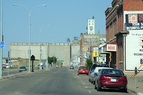
The trek back home to Brainerd started in earnest once I left the park. Although there are many ways to get to Brainerd from the city of Lake Bronson – adjacent to the park – I chose the one that would bring me through Grand Forks. I wanted to check out the city to ensure, I suppose you could say, that everything still appeared the same as when I left in May. For the most part, it did.

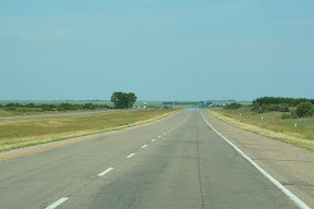
As the drive from the park to Grand Forks and Grand Forks to Brainerd was largely uneventful, and covered no territory that I haven’t already more or less thoroughly covered on here, I’ll just keep things short and say I made it home sometime around 7 in the evening. And with that, my superb 2007 vacation came to an end.

Pictures:

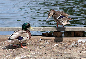
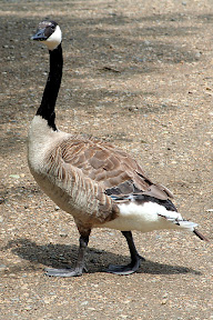
The first fourteen pictures were taken in Lake Bronson State Park

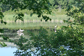
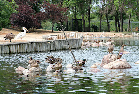
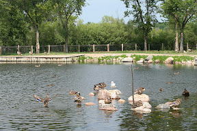
These three pelicans were looking for lunch in the lake


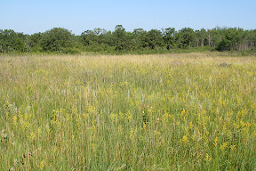
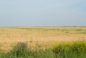
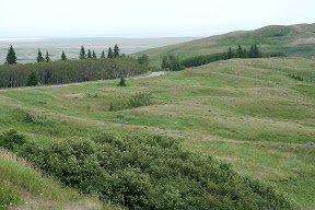
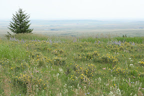
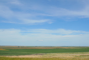
An example of tallgrasss prairie within the park


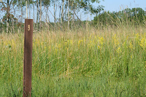
at trail marker #9 along the park's interpretive trail


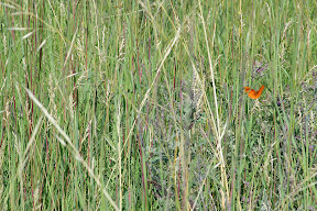
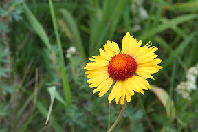
There were a lot of butterflies flying around in the prairie


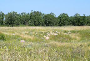
This depression was caused by a soil mining operation that was once located here


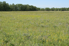
Another example of tallgrass paririe


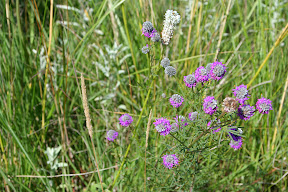
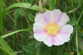
There were a lot of these purple flowers within the prairie - I don't know what these are called, but I believe they are an invasive species
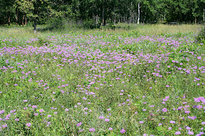

So purple!


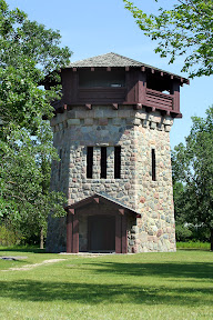
The water tower/observation tower


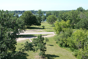
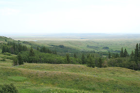
The view looking south from the tower


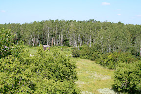
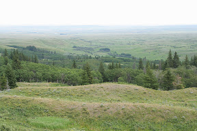
The view looking north from the tower - here's an example of an aspen forest within the park


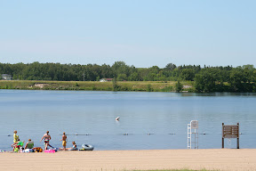
Even on a Tuesday morning, there were people enjoying the beach along Lake Bronson


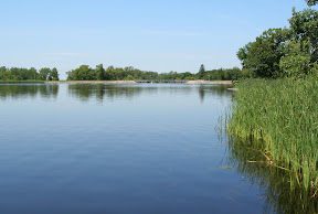
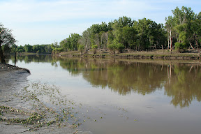
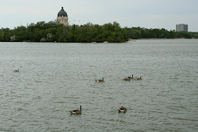
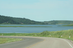
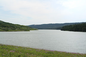
Another view of Lake Bronson


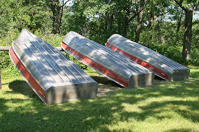
Nobody was canoing on the lake at the time


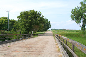
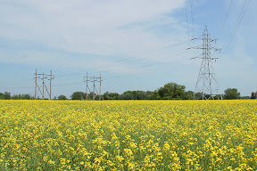
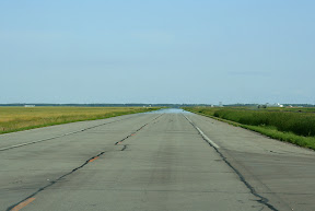
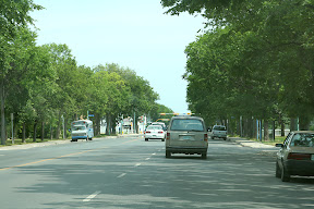
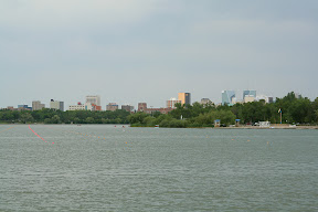
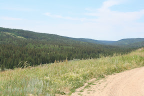
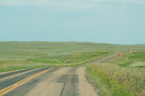
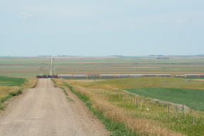
Scenery on a country road near Hawley

Videos:

Along the Shore of Lake Bronson

http://www.youtube.com/watch?v=fgsP30mUoqk

Sunday, August 05, 2007

2007 Vacation: Day 9 Summary

Day 9 Summary
Brandon, Manitoba to Hallock, Minnesota


Brandon's tourism slogan, “you belong in Brandon,” closely matched my feelings regarding the southwestern Manitoba city. In general, I found the city inhabited by 41,511 to be an exceptionally nice place to visit. It wasn’t that there were an abundance of tourist attractions, rather, it was just one of those cities that gave me good feelings.

One of the reasons for that might have been due to all the similarities I saw between Brandon and Grand Forks. Both cities are roughly the same size, both are situated in fertile river valleys, and both are significant centers of commerce and industry within their respective regions. Both cities actually have public universities within their boundaries as well, though Brandon University is quite a bit smaller than the University of North Dakota.

Besides stopping in at Safeway to get some exotic varities of potato chips, one of the chief places I visited in Brandon was the Riverbank Discovery Centre and adjacent hiking trails. The center provided some tourist information for the city of Brandon, while the trails wound around the Assinboine River and neighboring wetlands. There were even informative interpretive signs around a good portion of the trail network going through the wetlands.

At slightly past noon, I had to leave Brandon. I exited town heading east on the Trans-Can, which took me through some of the most agriculturally-developed land in Canada. Field after field of various crops could be seen alongside the road as it continued pressing deeper into the fertile, flat Red River Valley.

One of the more scenic sights along the way were the fields of canola. Though I had seen them since southwestern Saskatchewan, they seemed to become much more numerous as I traveled through southern Manitoba. These fields’ distinctive appearance made the landscape appear as if somebody took an airbrush and lightly painted it a school-bus yellow. It was quite striking, actually.

The biggest city in the 133 miles between Brandon and Winnipeg is Portage la Prairie (known locally as just "Portage"). This city of 12,748 is one of the leading centers of strawberry and potato production in North America. In fact, the J.R. Simplot Company opened an enormous potato processing plant there in 2003 to produce French fries for customers throughout Canada and the United States.

Portage la Prairie is also one of the most significant railroad centers in Canada, since it is situated along both the Canadian Pacific and Canadian National lines that run, more or less, across the country. Dozens of trains pass through Portage la Prairie on any given day.

Since I had already visited Winnipeg for a few days last October, I decided to detour around the city to get to the border. The first detour was Manitoba Highway 13 south from Newton to Roland, followed by Manitoba Highway 23 east from Roland to Morris. The scenery along these roads wasn’t anything spectacular, but I did get to see some more of those old grain elevators that I enjoy.

From Morris, it’s a quick 25 mile drive on Manitoba Highway 75 to the border and the Emerson, MB/Pembina, ND crossing. As was the case 4 days earlier in Montana, I made it across the border with little incident.

After taking a quick look around the historic city of Pembina, it was time to get on the road – predominantly U.S. Highway 75 – and travel 21 miles south to Hallock, one of the largest cities in extreme northwestern Minnesota.

Pictures:


These purple flowers were all over the wetlands next to the Assiniboine River in Brandon


There were also hundreds of these frogs in the wetlands


The Assiniboine River


Another view of the Assiniboine River


Feeding geese near the river


This "fuzzy" grass was growing in many places throughout the wetlands


(from left to right) The flag of Canada, Manitoba, city of Brandon, Ducks Unlimited Canada


A canola field near Portage la Prairie


The grain elevator near Kane


The grain elevator near Lowe Farm (or "Lowe F rm")


Red River Valley scenery near Morris


The Red River near Pembina - that's Minnesota on the other side; the Canadian border is about 2 miles up ahead


Scenery near Hallock along U.S. Highway 75

Videos:

No videos related to day 9

Labels: ,

Saturday, August 04, 2007

2007 Vacation: Day 8 Summary

Day 8 Summary
Moose Jaw, Saskatchewan to Brandon, Manitoba


Day 8 of my vacation started off on a beautiful note in the lovely city of Moose Jaw, Saskatchewan. The weather was sunny and pleasant as I looked around at one of the things the city of 31,132 is known for: its many intricate downtown murals. It really does seem like there’s one around every corner in the city’s historic downtown.

Although I didn’t see it, the downtown murals are topped as a tourist attraction by The Tunnels of Moose Jaw. Just as the name suggests, this attraction consists of a series of tunnels built underneath the city over a century ago. The tunnels represent one facet of Moose Jaw’s unsavory past, since they were once used as hideouts by smugglers and criminals, including the legendary Al Capone.

One of the reasons I didn’t have the chance to see the tunnels was because I wanted to see some things in Regina, a mere 47 miles to the east of Moose Jaw.

I caught my first glimpse Saskatchewan’s capital and second most populous city when I noticed Regina’s skyline appear suddenly on the horizon as I was traveling through farmland on the city’s western edge. The odd contrast in scenery was made possible due to Regina’s lack of suburbs. The city of 179,246 is pretty isolated amid the prairie.

One of Regina’s claims to fame is that it’s where all members of the Royal Canadian Mounted Police (RCMP) go through basic training. While the training grounds are largely off limits to civilians, the public is welcome at the northern end of the grounds, where the recently-completed RCMP Heritage Centre is located. I put this site at the top on my list of things to see while in Regina.

The center was put together extremely well. It offered a thorough, informative look into the past, present, and future of the RCMP. There was even a nice gift store with some RCMP swag. All in all, I’d highly recommend anybody visiting Regina to check the place out.

The next place in Regina I wanted to see was the vast Wascana Centre alongside Wascana Lake near the city’s center. This 3000 acre site in the heart of the city provides Reginians a place to enjoy all sorts of activities, including visiting museums, art galleries, walking, running, biking, or even kayaking on the lake that offers a nice view of the city’s skyline.

Although I didn’t have much time to visit all the center has to offer, I did make it to the Waterfowl Park, which is a 576 acre marshland home to all sorts of waterfowl, including Canadian Geese, mallard ducks, swans, and pelicans. I had a great time walking through and getting the chance to closely interact with all the birds.

Another place close to Wascana Centre is the ornate provincial capitol and a small, but dignified, veterans’ memorial across the street from it. Even the capitol grounds were being used at the time for recreation, as a group of people were playing Frisbee next to the building in the nice Sunday weather.

After spending more time in Regina than I probably should have, it was time to get back on the Trans-Can and head east. Since it was getting late in the afternoon, and crossing the border between Saskatchewan and Manitoba also meant losing an hour in crossing the Central Standard Time Zone and Central Daylight Time Zone, I had to hustle through the 224 miles between Regina and Brandon without doing much stopping.

It wasn’t a big loss, though, since there wasn’t all that much to see. The road passes through numerous small towns, some of which still have their classic Saskatchewan Wheat Pool grain elevators. I’m not exactly sure why, but I really enjoyed spotting these “prairie skyscrapers” as I traveled through Saskatchewan and Manitoba. They just seemed to have more character than grain elevators in the United States. It’s unfortunate that more and more are being decommissioned and removed.

It was after 8 PM when I finally approached Brandon, the second largest city in Manitoba and my destination for the day.

Pictures:


Downtown Moose Jaw


A street scene in Regina

The following five pictures were taken in the Waterfowl Park at the Wascana Centre


The Regina skyline as seen from Wascana Lake


The Saskatchewan capitol building is opposite the skyline on Wascana Lake

The following four pictures were taken at the veterans memorial across the street from the capitol

Her Majesty the Queen was here in 2005 when ground was broken for the memorial


The World War II monument


World War I monument


Just a few of the many names on the walls of the World War I monument

The following three pictures are of the Saskatchewan capitol building


The flag of Saskatchewan, Canada, and the United Kingdom


The majestic grain elevator in Whitewood


Scenery near the Saskatchewan-Manitoba border

Low-Grade Camcorder Pictures:


One of the murials in downtown Moose Jaw


Welcome to Manitoba

Videos:

At the Wascana Waterfowl Park in Regina

http://www.youtube.com/watch?v=hVmbxwoCwEI

Richardton's Ground Squirrel

http://www.youtube.com/watch?v=8S_y1UXF_24

Labels: ,

Friday, August 03, 2007

2007 Vacation: Day 7 Summary

Day 7 Summary
Medicine Hat, Alberta to Moose Jaw, Saskatchewan


I started day 7 of my vacation in Medicine Hat, Alberta. With the population of 56,997, the city, known locally as “The Hat” is the most populous in southeastern Alberta and without a doubt the center of commerce and industry in the region.

In case you were curious (I know I was), the name is derived from saamis, a Blackfoot word referring to the eagle tail feather headdress worn by medicine men – a “medicine hat.” The site where the city was founded had been a well-known meeting spot for Blackfoot, Cree, and Assiniboine nations for generations, thanks to its location in a gently sloping valley with converging waterways and hardy native cottonwood trees that attracted migratory bison herds.

Though the city was pretty quiet on a Saturday morning, I did get to see a few tourist attractions. One was the downtown Riverside Veterans' Memorial Park – which may or may not have been laden with drug dealers – and the other was “Saamis Teepee,” the world’s largest teepee. Standing over 20 stories tall, it was designed for the 1988 winter Olympics in Calgary as a symbol of Canada's Aboriginal heritage. For reasons unknown to me, it was moved to Medicine Hat in 1991.

After visiting those two attractions, as well as buying some Canadian souvenirs in a downtown shop, it was time to head east on the Trans-Canada Highway, referred to as Highway 1 in Alberta (and Saskatchewan and Manitoba).

I wasn’t on the Trans-Can for very long, however, before I turned off to take a little detour south to the Cypress Hills Interprovincial Park. This was one of the chief attractions I wanted to see in Canada. It’s quite a unique place in a few ways. First, it’s Canada’s only interprovincial park (since it located within both Alberta and Saskatchewan), and second, it has a unique geological history. The entire region escaped being glaciated during the last ice age. As a result, it has an appearance quite different from the surrounding countryside, and is actually also much higher in elevation than the surrounding countryside. The park's highest point, 4,816 feet above sea level, is the highest point in Canada in the nearly 2,000 miles between the Rocky Mountains and the Labrador Peninsula.

Although some of the park’s most popular activities include camping and fishing, I chose the tamer activity of merely enjoying the scenery from the half-paved, half-gravel road that meanders through the park. The drive was quite a leisurely one through the hills and jack pine forests (jack pine is usually called cyprès in Canadian French) that make up the park.

The road through the park ended in Saskatchewan about 22 miles east of where it started in Alberta. The park’s boundaries also ended at this point, as the road descended the Cypress Hills and entered a relatively flat, barren landscape peppered with wheat farms.

After touring the park, I got on Saskatchewan Highway 271 to travel about 28 miles north to Maple Creek, the most significant city in far southwestern Saskatchewan (population 2,270). From Maple Creek, the Trans-Can, which I needed to get back on to get to Moose Jaw, was still about 6 miles away. Eventually, I reached the desired highway and began taking it farther east.

The 187 miles between Maple Creek and Moose Jaw are pretty lonely. Other than small, agriculturally-significant towns with 1,000 or fewer inhabitants spaced every 10 or so miles apart, the biggest city along this stretch of roadway is Swift Current. The city of 14,946 is located roughly halfway between Medicine Hat and Moose Jaw.

Though I didn’t get to see that much, Swift Current seemed like a nice prairie community. Of utmost importance to me, it was big enough to sustain a Tim Hortons.

Scenery-wise, the landscape was transforming the farther east I went. From west to east, it became flatter, less arid, and dotted with an increasing number of farms. By the time I was ready to call it a day in Moose Jaw, the scenery started resembling that of the central Great Plains.

Pictures:


A downtown stoplight in Medicine Hat - Alberta prefers using horizontal stoplights


A statue in Medicine Hat's Riverside Veterans' Memorial Park dedicated to local World War I veterans

The following thirteen pictures were taken in the Cypress Hills Interprovicial Park

Elkwater Lake near the town of the same name


The welcome to Alberta sign also welcomed visitors to the park...


...The Saskatchewan welcome sign, however, was rather dull in comparasion


The welcome to Alberta sign that hikers on the Trans-Canada Trail see


There was a lot of cattle on the road weaving through the park


This is the scenery only a few miles away from the Cypress Hills - it's quite a dramatic difference between the hills and the surrounding countryside


Scenery near Herbert


Saskatchewan isn't called "land of living skies" for nothing - the skies were alive with continually changing clouds on the days I visited


The landscape is much flatter the closer you get to Moose Jaw

Video:

Scenic Overlook at Cypress Hills Interprovicial Park in Alberta

http://www.youtube.com/watch?v=xnQNhXsRcv4

Labels: ,

Previous Posts

Four Years Have Passed
Winter of 2007-08 Musings
7th Annual Top 10 Super Bowl Commercials
Another Birthday
A Beltated Update
2007 Vacation: Day 10 Summary
2007 Vacation: Day 9 Summary
2007 Vacation: Day 8 Summary
2007 Vacation: Day 7 Summary
2007 Vacation: Day 6 Summary

Archives

March 2004
April 2004
May 2004
June 2004
July 2004
August 2004
September 2004
October 2004
November 2004
December 2004
January 2005
February 2005
March 2005
April 2005
May 2005
June 2005
July 2005
August 2005
September 2005
October 2005
November 2005
December 2005
January 2006
February 2006
March 2006
April 2006
May 2006
June 2006
July 2006
August 2006
September 2006
October 2006
November 2006
December 2006
January 2007
February 2007
March 2007
April 2007
May 2007
June 2007
July 2007
August 2007
November 2007
December 2007
February 2008
March 2008
March 2012

Current Weather

Click for Brainerd, Minnesota Forecast Click for Grand Forks, North Dakota Forecast

Weather Station

Blogroll

Google Search

Google

Answers

Minnesota Counties

Minnesota Counties I've Visited

North Dakota Counties

North Dakota Counties I've Visited

Links

Subscribe to Mitch's Blog 

Through RSS
Click here to subscribe to Mitch's Blog through RSS!
Add to My 

Yahoo!
Add to Google

Free Image Hosting at Imageshack.us

Mitch's Blog Copyright 2001-2012 Mitch Wahlsten -- All Rights Reserved
The thoughts and opinions expressed are those of Mitch Wahlsten and the participants
Mitch's Blog began on December 23, 2001