
2007 Vacation: Day 7 Summary
Day 7 Summary
Medicine Hat, Alberta to Moose Jaw, Saskatchewan
I started day 7 of my vacation in Medicine Hat, Alberta. With the population of 56,997, the city, known locally as “The Hat” is the most populous in southeastern Alberta and without a doubt the center of commerce and industry in the region.
In case you were curious (I know I was), the name is derived from saamis, a Blackfoot word referring to the eagle tail feather headdress worn by medicine men – a “medicine hat.” The site where the city was founded had been a well-known meeting spot for Blackfoot, Cree, and Assiniboine nations for generations, thanks to its location in a gently sloping valley with converging waterways and hardy native cottonwood trees that attracted migratory bison herds.
Though the city was pretty quiet on a Saturday morning, I did get to see a few tourist attractions. One was the downtown Riverside Veterans' Memorial Park – which may or may not have been laden with drug dealers – and the other was “Saamis Teepee,” the world’s largest teepee. Standing over 20 stories tall, it was designed for the 1988 winter Olympics in Calgary as a symbol of Canada's Aboriginal heritage. For reasons unknown to me, it was moved to Medicine Hat in 1991.
After visiting those two attractions, as well as buying some Canadian souvenirs in a downtown shop, it was time to head east on the Trans-Canada Highway, referred to as Highway 1 in Alberta (and Saskatchewan and Manitoba).
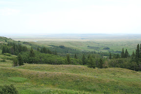
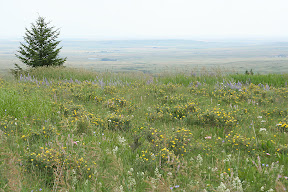
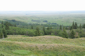
I wasn’t on the Trans-Can for very long, however, before I turned off to take a little detour south to the Cypress Hills Interprovincial Park. This was one of the chief attractions I wanted to see in Canada. It’s quite a unique place in a few ways. First, it’s Canada’s only interprovincial park (since it located within both Alberta and Saskatchewan), and second, it has a unique geological history. The entire region escaped being glaciated during the last ice age. As a result, it has an appearance quite different from the surrounding countryside, and is actually also much higher in elevation than the surrounding countryside. The park's highest point, 4,816 feet above sea level, is the highest point in Canada in the nearly 2,000 miles between the Rocky Mountains and the Labrador Peninsula.
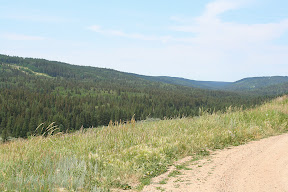
Although some of the park’s most popular activities include camping and fishing, I chose the tamer activity of merely enjoying the scenery from the half-paved, half-gravel road that meanders through the park. The drive was quite a leisurely one through the hills and jack pine forests (jack pine is usually called cyprès in Canadian French) that make up the park.
The road through the park ended in Saskatchewan about 22 miles east of where it started in Alberta. The park’s boundaries also ended at this point, as the road descended the Cypress Hills and entered a relatively flat, barren landscape peppered with wheat farms.
After touring the park, I got on Saskatchewan Highway 271 to travel about 28 miles north to Maple Creek, the most significant city in far southwestern Saskatchewan (population 2,270). From Maple Creek, the Trans-Can, which I needed to get back on to get to Moose Jaw, was still about 6 miles away. Eventually, I reached the desired highway and began taking it farther east.
The 187 miles between Maple Creek and Moose Jaw are pretty lonely. Other than small, agriculturally-significant towns with 1,000 or fewer inhabitants spaced every 10 or so miles apart, the biggest city along this stretch of roadway is Swift Current. The city of 14,946 is located roughly halfway between Medicine Hat and Moose Jaw.
Though I didn’t get to see that much, Swift Current seemed like a nice prairie community. Of utmost importance to me, it was big enough to sustain a Tim Hortons.
Scenery-wise, the landscape was transforming the farther east I went. From west to east, it became flatter, less arid, and dotted with an increasing number of farms. By the time I was ready to call it a day in Moose Jaw, the scenery started resembling that of the central Great Plains.
Pictures:
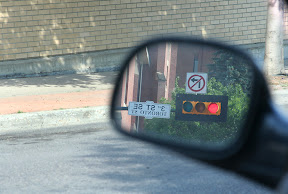
A downtown stoplight in Medicine Hat - Alberta prefers using horizontal stoplights
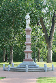
A statue in Medicine Hat's Riverside Veterans' Memorial Park dedicated to local World War I veterans
The following thirteen pictures were taken in the Cypress Hills Interprovicial Park
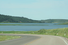
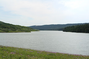
Elkwater Lake near the town of the same name
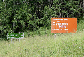
The welcome to Alberta sign also welcomed visitors to the park...
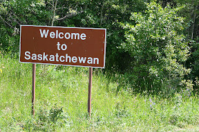
...The Saskatchewan welcome sign, however, was rather dull in comparasion
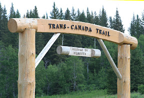
The welcome to Alberta sign that hikers on the Trans-Canada Trail see
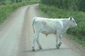
There was a lot of cattle on the road weaving through the park
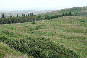
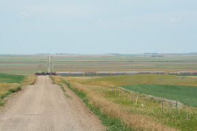
This is the scenery only a few miles away from the Cypress Hills - it's quite a dramatic difference between the hills and the surrounding countryside
Scenery near Herbert
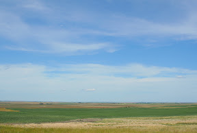
Saskatchewan isn't called "land of living skies" for nothing - the skies were alive with continually changing clouds on the days I visited
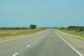
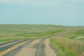
The landscape is much flatter the closer you get to Moose Jaw
Video:
Scenic Overlook at Cypress Hills Interprovicial Park in Alberta
http://www.youtube.com/watch?v=xnQNhXsRcv4
A downtown stoplight in Medicine Hat - Alberta prefers using horizontal stoplights
A statue in Medicine Hat's Riverside Veterans' Memorial Park dedicated to local World War I veterans
The following thirteen pictures were taken in the Cypress Hills Interprovicial Park
Elkwater Lake near the town of the same name
The welcome to Alberta sign also welcomed visitors to the park...
...The Saskatchewan welcome sign, however, was rather dull in comparasion
The welcome to Alberta sign that hikers on the Trans-Canada Trail see
There was a lot of cattle on the road weaving through the park
This is the scenery only a few miles away from the Cypress Hills - it's quite a dramatic difference between the hills and the surrounding countryside
Scenery near Herbert
Saskatchewan isn't called "land of living skies" for nothing - the skies were alive with continually changing clouds on the days I visited
The landscape is much flatter the closer you get to Moose Jaw
Video:
Scenic Overlook at Cypress Hills Interprovicial Park in Alberta
http://www.youtube.com/watch?v=xnQNhXsRcv4
Labels: 2007 Vacation, Pictures
posted by Mitch Wahlsten at 10:10 PM
0 comments
![]()


0 Comments:
Post a Comment
<< Home