
2007 Vacation: Day 6 Summary
Day 6 Summary
Great Falls, Montana to Medicine Hat, Alberta
Slightly to my surprise, the city of Great Falls ended up being quite a pleasant place to visit. With a population of 56,690, it’s an anomaly in a region dotted with towns of less than 1,000 people.
Great Falls got its name due to its proximity to five daunting waterfalls on the Missouri River. While the waterfalls were an obstacle for the Lewis & Clark Expedition and early river explorers to navigate around, today they provide an abundance of hydroelectric power. In fact, Great Falls is known as “The Electric City” because of all the hydroelectric dams located close by.
Three of the dams and waterfalls are on display on the northeast side of town in the small, but picturesque, Giant Springs State Park. Besides some scenic overlooks showcasing the Missouri River, waterfalls, and dams, the park also contains one of the largest natural, cold water springs in the world, a state trout hatchery, and the Roe River, which qualifies – in the Guiness Book of World Records, anyway – as the shortest river in the world. It flows a mere 58 feet from the springs to the Missouri River.
I found the park to be a very worthwhile place to visit. Also worthwhile to see is the fairly new Lewis & Clark National Historic Trail Interpretive Center operated by the USDA Forest Service right next to the state park. The center interprets the story of the expedition from its beginning to end.
After looking around the park and interpretive center (where I found a nice book about the Yellowstone River), it was time to leave Great Falls and head north. There was a still a long drive to the day’s final destination of Medicine Hat, Alberta. Plus, I had to get through customs at some point.
There aren’t really any side roads in the area, so the lonely Interstate 15 was the only viable road to take to travel the 118 miles between Great Falls and the Canadian border.
For the most part, the 118 miles was filled with a lot of vast, barren fields. Every so often, the road passed alongside small towns recognizable as such for miles away thanks to a towering grain elevator or two. Conrad and Shelby, 60 and 85 miles north of Great Falls, respectively, were two of the most significant cities along the way. Still, those cities only had a couple thousand people; this area of Montana is incredibly sparsely populated.
For the most part, the landscape consisted of gentle, rolling hills. One exception to this was about 8 miles south of Shelby, where the road enters the deep valley of the Marias River. The river has a bit of an interesting history. It was explored in 1807 by the Lewis & Clark Expedition after some men on the expedition mistook it for the main branch of the Missouri. Eventually, after finding the waterfalls of the Missouri near Great Falls, the expedition realized it had made a wrong turn. Meriwether Lewis then named the newly-discovered tributary of the Missouri after his cousin, Maria Wood.
Interstate 15 became exceedingly lifeless near the town of Sunburst, 8 miles south of the border. There wasn’t much in the way of traffic except for a few semi trucks and vehicles with Alberta license plates. It’s a far cry from the scene encountered at the interstate’s southern terminus in San Diego.
The road finally reaches the border at the twin cities of Sweetgrass, Montana and Coutts, Alberta. Customs took about 10 minutes to get through (mostly because only one booth was open for all non-truckload traffic), but I ultimately made it into Alberta with little hassle.
The biggest change on the other side of the border was that all the signs were in metric. In terms of scenery, the Albertan landscape looked like the one I had gotten used to seeing in Montana.
From Coutts, it was about 24 miles to the small town of Warner, where I diverged from Alberta Highway 4 (which I had been on since the border) to Alberta Highway 36. This highway ran for a lonely 37 miles to Taber, where it intersected Alberta Highway 3. In order to get to Medicine Hat, I had to travel east down this road for about 72 miles.
The road between Taber and Medicine Hat passed through some small towns with interesting names – Purple Springs, Grassy Lake, Bow Island, and, my favorite, Seven Persons – but didn’t offer much in the way of distinctive scenery. To keep things short, I’ll just mention that I made it into my destination of Medicine Hat slightly after 6 PM.
Pictures:
The first thirteen photos were taken in Giant Springs State Park near Great Falls
The site from which this picture was taken is called the Rainbow Falls Overlook
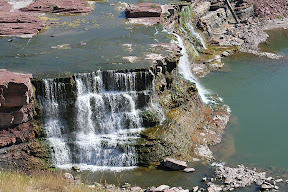
Rainbow Falls
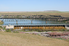
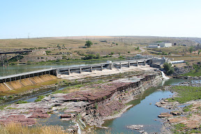
A view of the dam at Rainbow Falls
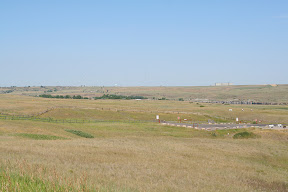
Looking south toward the city of Great Falls
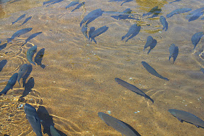
One of the ponds at the trout hatchery - these fish, which are much larger than the ones ordinarily released into the water, are the only ones the public is allowed access to
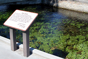
This is the smallest river in the world
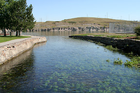
Another view of the smallest river in the world shows the point where it empties into the Missouri River
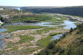
The Missouri River

A few canoeists were out on the Missouri River
One more view of the Missouri River
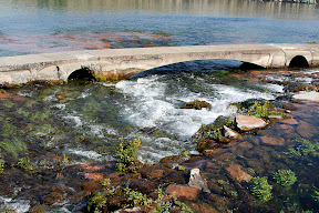
This is what gave the state park its name - these are the "giant springs"
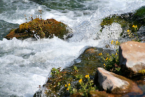
Another view of the gushing water in the springs
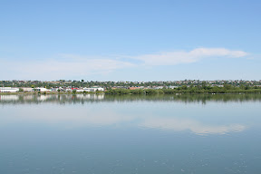
A view of the Missouri River closer to the main part of Great Falls
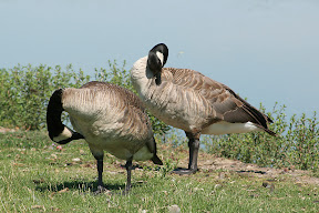
There were a lot of Canadian geese lounging around on the river's shore
The scenery along Interstate 15 near Shelby
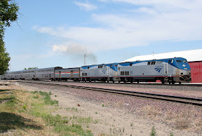
The eastbound Empire Builder leaving Shelby following a five minute station stop
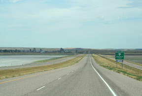
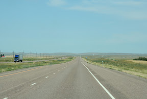
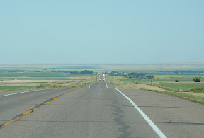
Interstate 15 near Sunburst, about 9 miles south of the border - notice that there are absolutely no vehicles on the interstate at this point
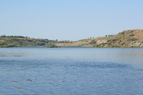
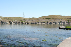
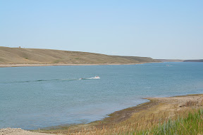
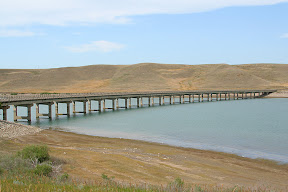
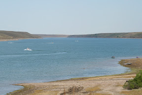
The following three pictures were taken from a recreation area on a reservoir near Warner in southern Alberta
Southeastern Alberta scenery
Video:
Canadian Geese along the Missouri River in Great Falls
http://www.youtube.com/watch?v=wVsKZ8wTSaQ
The first thirteen photos were taken in Giant Springs State Park near Great Falls
The site from which this picture was taken is called the Rainbow Falls Overlook
Rainbow Falls
A view of the dam at Rainbow Falls
Looking south toward the city of Great Falls
One of the ponds at the trout hatchery - these fish, which are much larger than the ones ordinarily released into the water, are the only ones the public is allowed access to
This is the smallest river in the world
Another view of the smallest river in the world shows the point where it empties into the Missouri River
The Missouri River
A few canoeists were out on the Missouri River
One more view of the Missouri River
This is what gave the state park its name - these are the "giant springs"
Another view of the gushing water in the springs
A view of the Missouri River closer to the main part of Great Falls
There were a lot of Canadian geese lounging around on the river's shore
The scenery along Interstate 15 near Shelby
The eastbound Empire Builder leaving Shelby following a five minute station stop
Interstate 15 near Sunburst, about 9 miles south of the border - notice that there are absolutely no vehicles on the interstate at this point
The following three pictures were taken from a recreation area on a reservoir near Warner in southern Alberta
Southeastern Alberta scenery
Video:
Canadian Geese along the Missouri River in Great Falls
http://www.youtube.com/watch?v=wVsKZ8wTSaQ
Labels: 2007 Vacation, Pictures
posted by Mitch Wahlsten at 5:09 PM
2 comments
![]()


2 Comments:
nice scenery. any trees there? sw
No, not that many.
Post a Comment
<< Home