
2007 Vacation: Day 5 Summary
Day 5 Summary
Billings, Montana to Great Falls, Montana
Day 5 of my 2007 vacation involved covering some territory I’d never traveled in before, so there’ll be no need to link to something I wrote last year.
The day started off in Billings by first going to visitors' center to get some electricity, since I had forgotten to recharge the battery on my camera. Oops. After successfully getting the battery charged, it was off to downtown Billings and the Western Heritage Center.
The museum, housed in Billings’ former public library, houses several different exhibits relating to the history of Billings. As luck would have it, 2007 is the 125th anniversary of the founding of Billings, so there were all sorts of special artifacts on display. There was even a theater presentation from KTVQ, Billings’ CBS affiliate, of video clips chronicling significant events in the city’s history.
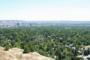
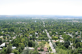
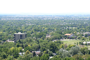
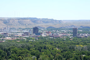
After taking a look around the museum, I made it up to the rimrocks on the northern edge of Billings. The rimrocks are essentially steep cliffs that line the Yellowstone River Valley in which Billings is located. By taking one of two routes from downtown Billings, you can get on top of the rimrocks and look out on the entire city. It’s actually quite an amazing view.
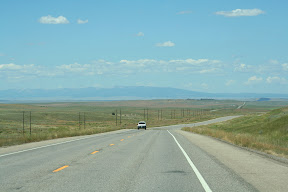
After looking around at Billings for a bit, I got on Montana Highway 3 to head north. The landscape was definitely quite different than the one I had witnessed in the Yellowstone River Valley the previous day. Fertile, forested land alongside the river was replaced with a hilly, arid landscape dotted here and there with ranches or wheat farms.
The countryside was like that through the town of Broadview and for about 40 miles north of Billings. Then, in the town of Lavina and near the turn for U.S. Highway 12, the road entered another lush valley, this time the one of the Musselshell River.
As I traveled Highway 12 for the 45 miles between Lavina and Harlowton, the nearby river made it appear as if I was traveling through an entirely different state. The surroundings were very green, and there were trees everywhere.
I traveled through another abrupt change in scenery north of Harlowton, however, as I got off of Highway 12 to begin traveling north on U.S. Highway 191.
About 17 miles north of Harlowton, the road passes through Judith Gap, which is both a small town and geological feature. The town didn’t have much to see, but the geological feature was pretty neat. It’s just a big, flat gap, discovered during the Lewis & Clark Expedition, between the Little Belt Mountains to the west and the Big Snowy Mountains to the east. These mountains, rather mediocre by Rocky Mountain standards, would be the only ones I would get close to during my 2007 vacation.
Near the town of Moore, the road stops going straight, and motorists must turn either right or left. Turning right brings you back east to Glendive, while turning left brings you to Great Falls. Since my destination was the latter, turning left was the correct way to go.
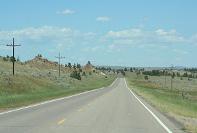
The road west of Moore provides some more striking glimpses of the Little Belt Mountains as it winds its way through a flat, barren, treeless landscape near their northern slopes. The road also passes through some dying small towns – Hobson, Moccasin, Stanford, and Geyser – as it continues toward Great Falls.
For about 12 miles between the towns of Raynesford and Armington, the road dives into a deep, narrow valley. The road and paralleling railroad tracks both hug the valley’s walls in what ended up being one of the most scenic portions of the drive between Billings and Great Falls.
The road ascended the valley near Armington, and continued its journey through what’s referred to as the Judith Basin. It’s a barren, listless area starved for moisture by being so close to the eastern edge of the Rocky Mountains.
In due course, Great Falls – the third largest city in Montana with a population of 56,690 – appeared out of nowhere. It was in this oasis of north-central Montana that I spent the night.
Pictures:
The first six pictures were taken from on top of the rimrocks in Billings. Unfortunately, I visited this site in the late morning, so the lighting wasn't ideal.
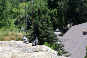
These two doves were walking back and forth, undoubtedly checking out the view below
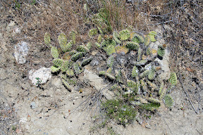
It's amazing how dramatic the scenery contrasts here - while the city of Billings below is lush and green, cacti are able to grow on top of the rimrocks
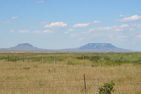
The Little Belt Mountains can be seen of in the distance near Broadview
The roadway near Lavina
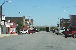
Downtown Harlowton
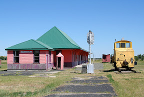
The Harlowton depot along with some railroad artifacts

About to pass through the Judith Gap
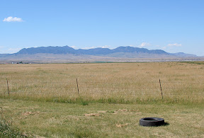
The Big Snowy Mountains near Judith Gap
Some plateaus that belong to the Little Belt Mountains
There were a number of steep cliffs like this near Raynesford

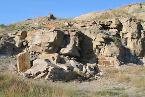
MDOT doesn't want you to climb the rocks
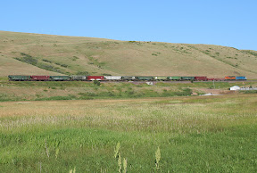
A southbound train is about to enter Raynesford
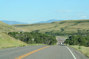
Some typical scenery between Raynesford and Armington
Video:
At the Rimrocks in Billings
http://www.youtube.com/watch?v=TjxU11gdZBU
The first six pictures were taken from on top of the rimrocks in Billings. Unfortunately, I visited this site in the late morning, so the lighting wasn't ideal.
These two doves were walking back and forth, undoubtedly checking out the view below
It's amazing how dramatic the scenery contrasts here - while the city of Billings below is lush and green, cacti are able to grow on top of the rimrocks
The Little Belt Mountains can be seen of in the distance near Broadview
The roadway near Lavina
Downtown Harlowton
The Harlowton depot along with some railroad artifacts
About to pass through the Judith Gap
The Big Snowy Mountains near Judith Gap
Some plateaus that belong to the Little Belt Mountains
There were a number of steep cliffs like this near Raynesford
MDOT doesn't want you to climb the rocks
A southbound train is about to enter Raynesford
Some typical scenery between Raynesford and Armington
Video:
At the Rimrocks in Billings
http://www.youtube.com/watch?v=TjxU11gdZBU
Labels: 2007 Vacation, Pictures
posted by Mitch Wahlsten at 4:58 PM
0 comments
![]()


0 Comments:
Post a Comment
<< Home